.jpg?resize=410x0)
Thurber’s Expertise
Monitoring the Earth's Stability
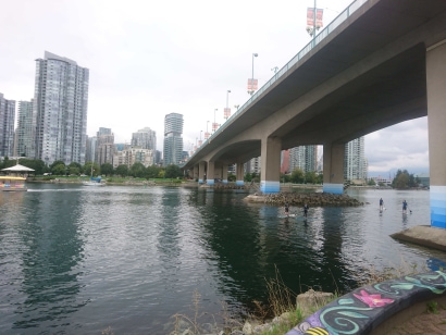
Much of Canada's infrastructure passes through geologically challenging areas; steep valleys, winding rivers, rocky terrain, and varying climates all pose geotechnical and geological challenges.
We understand how rocks move, how to stabilize soils to minimize liquefaction, and the requirements for selecting proper routing for infrastructure and transportation projects. We help our clients classify rocks, design rock support and anchors to mitigate rockfall, assess landslides, investigate avalanche chutes, develop flood control solutions, and design buildings to respond to seismic events.
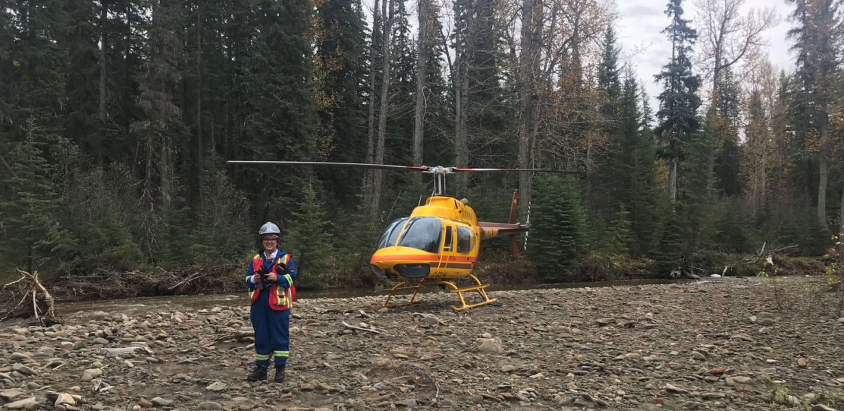
Our team brings extensive experience in steep terrain engineering. We use LiDAR, drones, and GIS to support our investigations in difficult to reach areas.
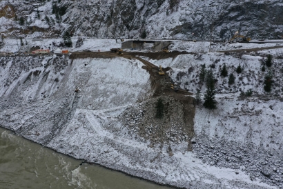
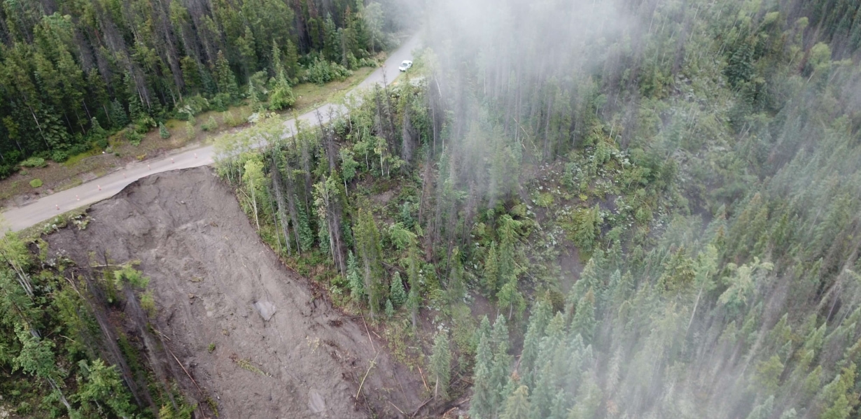
Slopes can be found in various natural and man-made landscapes and include hillsides, embankments, and cuttings. Thurber’s engineers and geoscientists assess the static and dynamic stability of slopes in soil and rock. If slopes are unstable, we develop mitigation measures to enhance the safety of infrastructure such as roadways and mining operations. We specialize in the identification of landslide-triggering mechanisms, deterministic and probabilistic landslide hazard assessments, site investigation, field instrumentation, movement monitoring, laboratory testing, debris flows, coastal erosion, earthquake-induced slope movements, and design of stabilization works. Our slope stability engineers, geologists, and geoscientists work together to mitigate climate change-related slope instability and provide emergency response when landslides and debris floods occur.
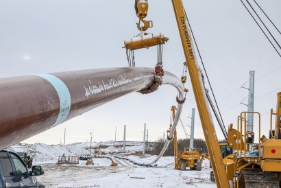
When building a highway, railway, pipeline, hydroelectricity project, or transmission line through complex terrain, it is important to involve Thurber to assist in route selection and
construction methodology. Terrain analysis involves identifying geological landforms and potential hazards (landslides, rockfall, debris flows, avalanches) and developing appropriate
engineering solutions to address safety, stability, and long-term performance. It is well suited for conceptual and preliminary planning for linear projects and the identification of
borrow/aggregate sources.
Thurber maintains a comprehensive geospatial database of published and in-house geotechnical/geological reports and maps to assist in terrain mapping and analysis, including:
- Airphoto interpretation and landform mapping
- Terrain visualization using DEM and LiDAR
- Geohazard mapping and risk analysis
- Route selection for pipelines, roads, and power transmission lines
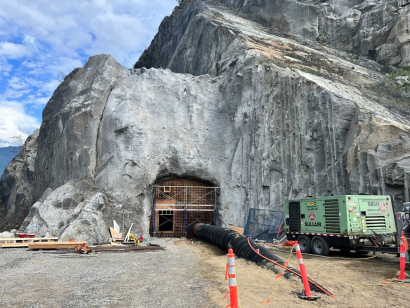
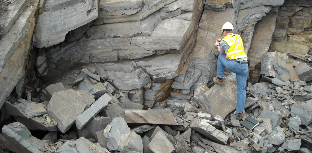
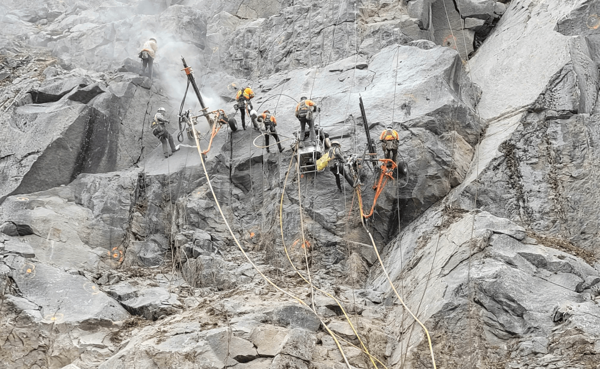
The design of structures built on bedrock requires an in-depth knowledge of geology and rock mechanics. Rock mass classification systems along with numerical modelling techniques and 3D
models are often used for design and mitigation purposes. Thurber provides geotechnical drilling, surface mapping, advanced laboratory and in-situ testing, bedrock mapping, core logging,
discontinuity mapping, rock slope stability analyses and stabilization, retaining wall design, geohazard assessment, rock mass classification systems, rock anchor design, blast vibration
monitoring, and metal leaching/acid rock drainage assessments. Our rock engineers support transportation and pipeline projects in rocky terrain, and underground excavations.
Earthquakes can cause significant structural damage. Thurber’s engineers provide full soil structure analysis to understand the seismic history of the site and the soil’s stability and liquefaction potential. By modelling the soils and understanding their strength, we design ground densification solutions that allow the soils to better withstand vibration and limit liquefaction, thereby minimizing damage to the built structure in the event of a seismic event. We work in earthquake-prone regions to help design, build, and maintain resilient infrastructure.
We have contributed our expertise to guidelines including the Seismic Assessment and Seismic Design of Dikes in British Columbia, the BC School Seismic Retrofit Guidelines and the Ministry of Transportation Ontario’s Seismic Analysis Requirements.
Our areas of specialization include:
- Liquefaction triggering
- Site response analysis
- Soil structure interaction
- Seismic deformation analysis using Plaxis
We have in-house capacity to measure shear wave velocity for our clients. Our downhole seismic testing provides in-situ analysis of the shear wave velocity of the site, allowing us to provide an accurate seismic site classification and carry out site specific response analysis.
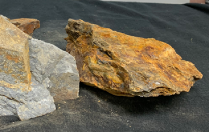
Metal leaching/acid rock drainage (ML/ARD) is a naturally occurring environmental issue that can be made significantly worse when susceptible rock is disturbed by excavation, blasting or
crushing etc. Disturbance can expose sulfide and other minerals in the rock to moisture and oxygen initiating oxidation (i.e. rusting), potentially resulting in the generation of sulfuric
acid and the release of high concentrations of sulfate and dissolved metals. ML/ARD is a significant environmental issue as it can runoff into nearby watercourses injuring or killing aquatic
life, including fish and vegetation.
ML/ARD assessment is mandated for infrastructure projects in British Columbia, including road, highway, pipeline and land development projects, and for the quarries that supply these projects with crushed bedrock material.
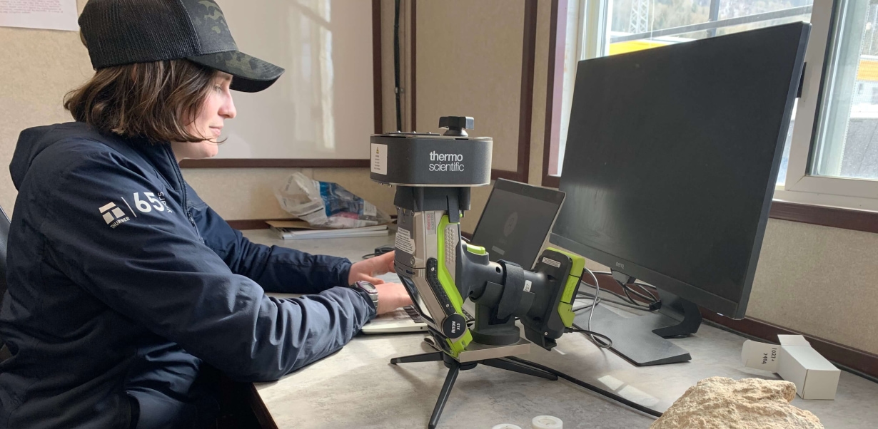
Thurber offers a range of ML/ARD assessment services including the implementation of ML/ARD assessment programs conforming to the requirements of BC MoTI Technical Circular T-04/13, geological survey and bedrock geology mapping and the interpretation of both static and kinetic data. Thurber has also developed a rapid non-destructive testing methodology that can be employed on a range of projects. The methodology uses portable X-Ray fluorescence meters (pXRF) to detect and measure elemental compositions in minutes. Use of this rapid assessment methodology allows for quick decision making on larger construction projects, thereby saving time and money.
If ML/ARD or ML/ARD-prone rock is found, we can provide detailed management plans and/or mitigation designs.
When needed, we provide pre-construction (baseline), construction or post-construction phase environmental monitoring for ML/ARD, including the assessment of surface or groundwater quality, to track mitigation effectiveness.
Thurber has extensive experience in incorporating remote sensing techniques into geohazard assessment and management programs. Remote sensing helps us understand the environment, monitor changes over time, and make informed decisions - all from afar.
Our remote sensing tools include:
AIRPHOTO INTERPRETATION
Airphotos provide valuable insight into the earth’s surface and subsurface characteristics. Our geotechnical engineers and geoscientists use airphotos to gather
essential information about topography, landforms, and geological features (gullying, soil types, soil moisture content, land use type) to help our clients understand
potential risks such as landslides. Airphotos also help locate and assess the suitability of construction sites, determine soil types, and understand the spatial distribution of geological
formations.
INSTRUMENTATION TELEMETRY
Using instrumentation tools like inclinometers (to measure slopes) and peizometers (to measure water pressure in the ground), we can understand how the ground and structures are behaving over time and under different conditions. This helps us ensure the safety and stability of a structure and allows for proactive decision making to prevent disasters.
LIDAR
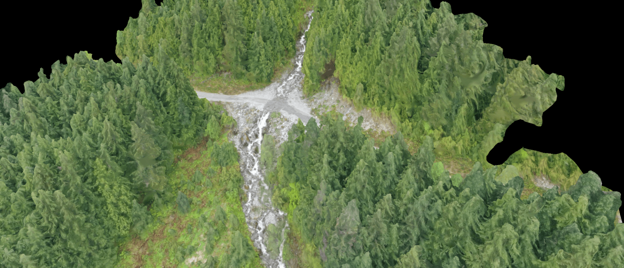
Light detection and ranging (LiDAR) gathers precise and detailed data about the earth's surface and subsurface. It uses pulses to measure the distance between the
LiDAR sensors and objects and creates accurate 3D models of the terrain. Thurber uses this information to understand a site's topography and any potential hazards such
as landslide risk or floods. We often combine our LiDAR mapping with ground-penetrating radar to understand the shallow subsurface layers and gain better insight into
soil properties and potential construction challenges. This allows us to help our clients plan construction projects.
DRONE OBSERVATION
Thurber's certified drone pilots gather high-quality photos to complement or replace observations from helicopters or the ground. Drones are a cost-effective way to access difficult-to-reach sites such as high bridge decks or hazardous areas.
INSAR
Interferometric synthetic aperture radar (InSAR) uses satellite technology to take pictures of the ground over different times and compares them to detect differences.
This helps us understand if the ground has moved or changed, and therefore if structures are at risk.
PHOTOGRAMMETRY
Thurber uses photogrammetry to create accurate 3D models or measurements of objects and environments using photographs. Photogrammetry helps us identify
distinct features in the landscape and calculate the distance between points.
Advanced numerical modelling uses sophisticated computer-based techniques to simulate and analyze the behaviour of soil and rock in complex situations. Thurber’s engineers use a combination of specialized geotechnical software and 2D/3D software suites to assess a variety of geotechnical applications including:
- Slope stability
- Settlement and lateral deformation
- Seismic and dynamic site response
- Single and group pile capacity and movement
- Foundation design
- Excavation shoring and anchor performance
- Tunnel performance
- Seepage and groundwater flow
- Liquefaction resistance
- Debris flows
- Rock falls
Our engineers work closely with our advanced geotechnical laboratory to collect the appropriate information to develop the numerical models. The program then creates a virtual representation of the system. This virtual model can simulate various scenarios and predict how the system will behave under different loading conditions. Numerical models allow for the exploration of scenarios that are difficult or expensive to replicate in real life.
These models help our engineers evaluate different design options, identify potential issues, optimize design and develop solutions during design and construction.
FEATURED PROJECTS
.jpg?resize=410x0)