Thurber’s Expertise
Managing Geological Risks
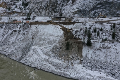
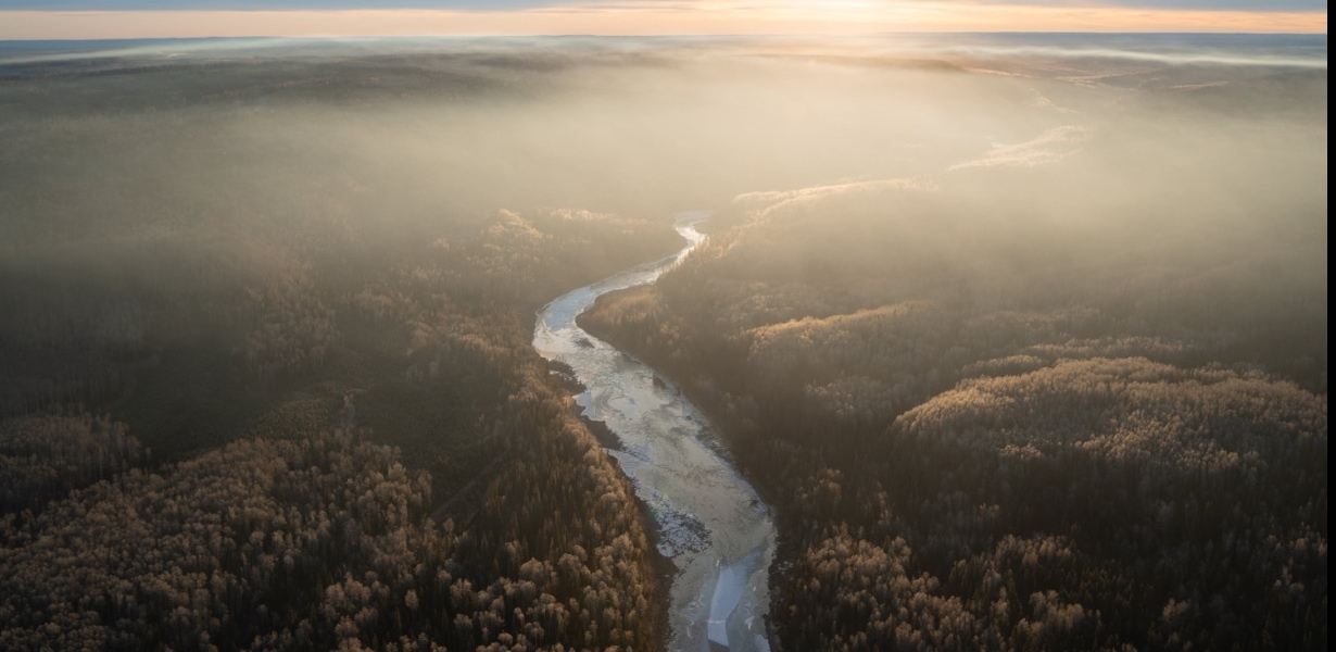
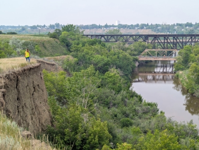
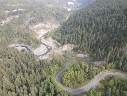
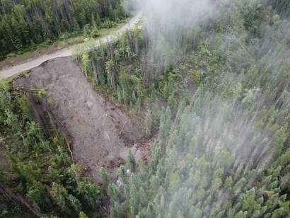
Steep slopes create challenges to infrastructure due to rock fall, avalanche, flood, and landslide risk. This is becoming worse due to climate change. We specialize in steep terrain and geologically challenging areas. Our services help our clients understand the risks posed by geohazards and develop methods for managing that risk.
We have experience designing, coordinating, and executing geohazard assessments and management programs for:
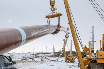
- Pipeline routing, design, and construction
- Operating pipeline systems
- Roads and railways
- Communities
Here’s how a good geohazard program helps your project
- Safe operations
- Reduces operational costs through proactive management
- Helps to plan for mitigation and/or replacement costs
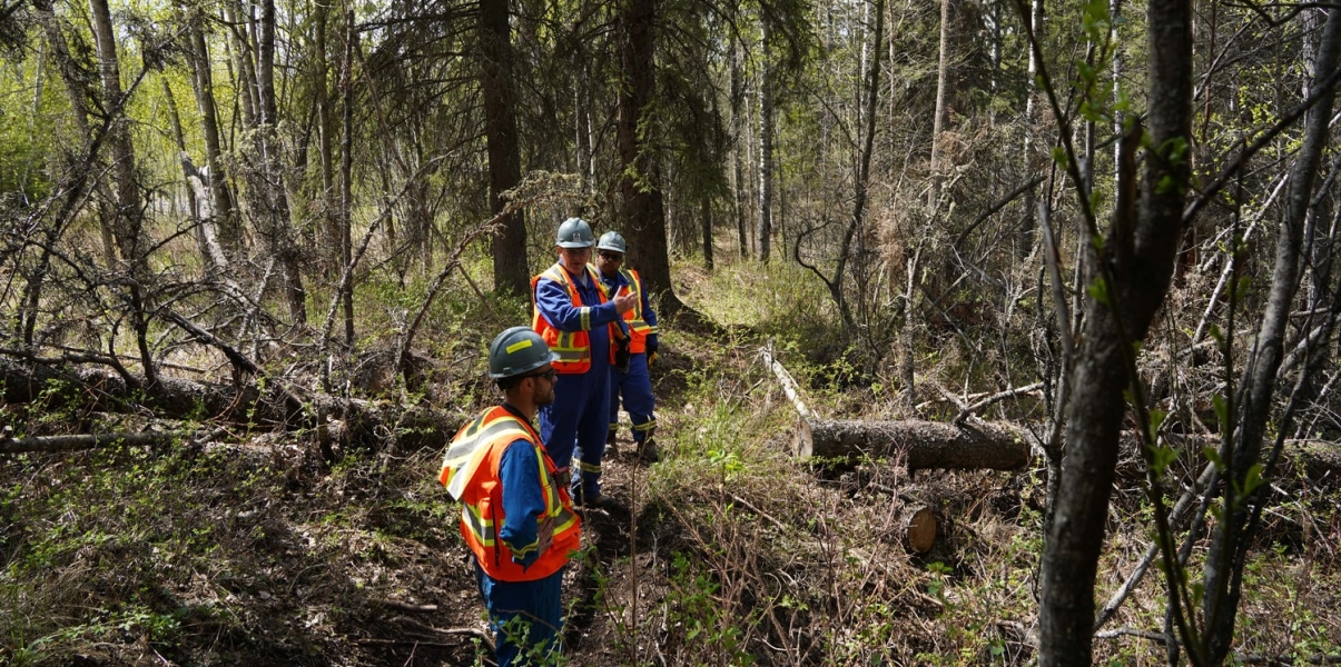
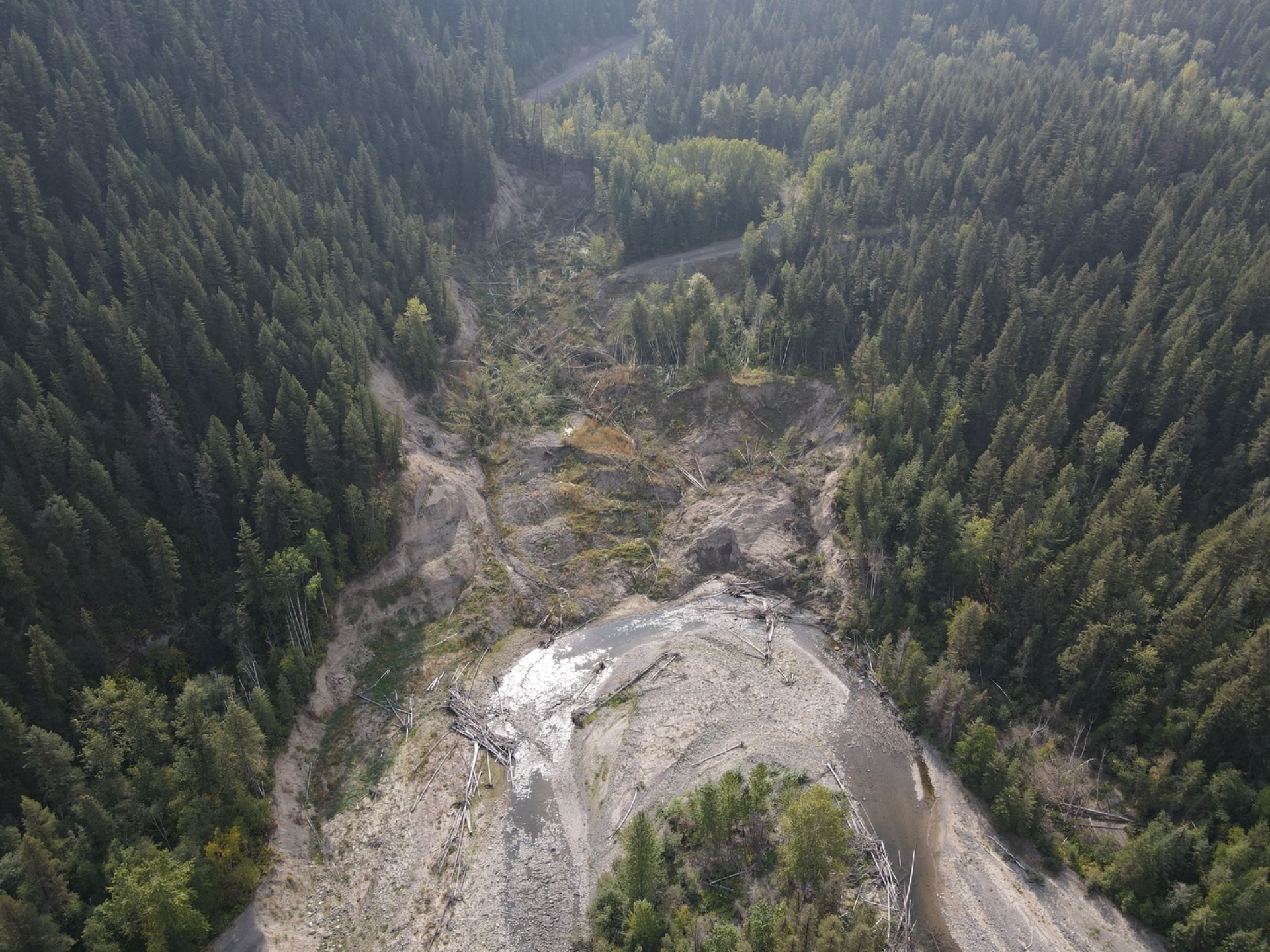
Geological processes can lead to situations that pose risks to infrastructure, the environment, or life. Rocks can fall on a busy highway, a landslide can wipe out a house, or a pipeline can be ruptured by a flood. Thurber’s engineers serve our clients to assess and understand the potential geohazard risks to their proposed or existing assets. We are adept at analyzing and managing geohazards in a variety of physiographic regions. We routinely undertake helicopter and drone reconnaissance of remote sites, conduct hazard mapping, and interpret remote sensing data to identify potential geohazards in the early stages of project planning.
Thurber provides emergency support for highways and infrastructure impacted by climate events so that roads can be reopened quickly. Following a climate event, we provide mitigation planning for future events.
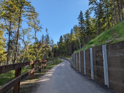
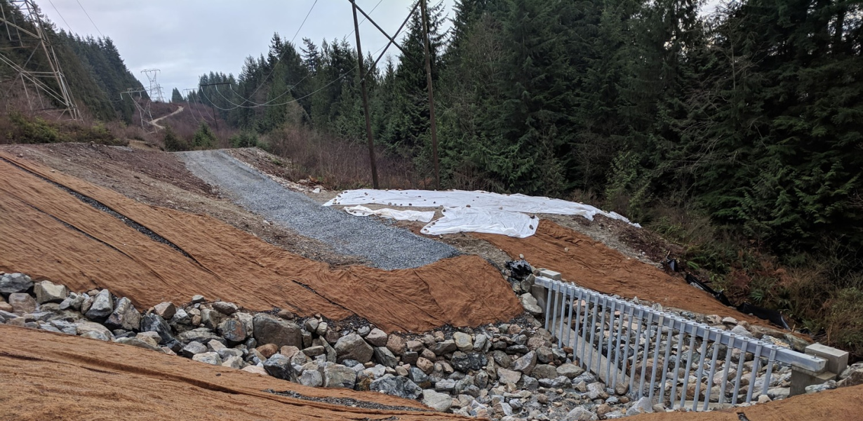
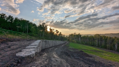
Where geohazard mitigation is required, we design both short-term and long-term remedial and stabilization measures. This includes:
- Slope stabilization engineering
- Erosion and sedimentation control
- Rock fall protection barriers
- Debris flow barriers
- Rock bolting
- Strain reliefs
- Pipeline replacement and reroutes
- Aerial crossing design support
We help manage risk to the general public by putting controls in place that monitor the site and provide us with live reports of any perceived changes to conditions. These remotely operated
instruments help us make quick, informed decisions about public safety, including whether a road needs to be closed.
Climate change influences existing regionally-specific geohazards, making them occur more often, and / or with increased severity, including floods and slope instability caused by changes to
precipitation, temperature variations including rain-on-snow events and drought or heatwave-induced wildfires. These geohazards can threaten public safety and infrastructure. Thurber’s
engineers and geoscientists can assess these climate-induced geohazards and develop mitigation strategies that address potential risks. We also support stakeholder engagement to develop
optimal assessment criteria and identify key assessment deliverables specific to your project needs.
Inertial Measurement Unit (IMU) data is an effective tool for assessing geohazard interactions on a pipeline through interpretation of bending strain and tool positioning data.
While vendor algorithms may identify a few select anomalous strain signatures, they often miss more subtle indications of geohazard interactions which may be indicative of much more serious integrity concerns. Thurber provides detailed assessments and interpretations of IMU data combined with site-specific geohazard assessments to develop an accurate assessments of geohazard threats to pipeline integrity. Thurber can support various levels of assessments, including:
- High-level screening for potential interactions
- Interpretation of vendor screening reports
- Detailed interpretation of raw single-run IMU data
- Detailed assessments of raw run to run IMU data
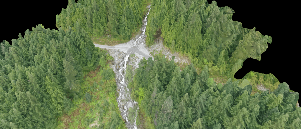
Thurber has extensive experience in incorporating remote sensing techniques into geohazard assessment and management programs. Remote sensing helps us understand the environment, monitor changes over time, and make informed decisions - all from afar. Our technical expertise can help with selecting the right tool for the application as well as scoping the data collection and analysis methods.
Our remote sensing tools include:
Airphoto interpretation
Airphotos provide valuable insight into the earth’s surface and subsurface characteristics. Our geotechnical engineers and geoscientists use airphotos to gather
essential information about topography, landforms, and geological features (gullying, soil types, soil moisture content, land use type) to help our clients understand
potential risks such as landslides. Airphotos also help locate and assess the suitability of construction sites, determine soil types, and understand the spatial distribution of geological
formations.
Instrumentation Telemetry
Using instrumentation tools like inclinometers (to measure slopes) and peizometers (to measure water pressure in the ground), we can understand how the ground and structures are behaving over time and under different conditions. This helps us ensure the safety and stability of a structure and allows for proactive decision making to prevent disasters.
Lidar
Light detection and ranging (LiDAR) gathers precise and detailed data about the earth's surface and subsurface. It uses pulses to measure the distance between the
LiDAR sensors and objects and creates accurate 3D models of the terrain. Thurber uses this information to understand a site's topography and any potential hazards such
as landslide risk or floods. We often combine our LiDAR mapping with ground-penetrating radar to understand the shallow subsurface layers and gain better insight into
soil properties and potential construction challenges. This allows us to help our clients plan construction projects, and protect workers and the public.
DRONE OBSERVATION
Thurber's certified drone pilots gather high-quality photos to complement or replace observations from helicopters or the ground. Drones are a cost-effective way to access difficult-to-reach sites such as high bridge decks or hazardous areas.
InSAR
Interferometric synthetic aperture radar (InSAR) uses satellite technology to take pictures of the ground over different times and compares them to detect differences.
This helps us understand if the ground has moved or changed, and therefore if structures are at risk.
Photogrammetry
Thurber uses photogrammetry to create accurate 3D models or measurements of objects and environments using photographs. Photogrammetry helps us identify
distinct features in the landscape and calculate the distance between points.
Advanced numerical modelling uses sophisticated computer-based techniques to simulate and analyze the behaviour of soil and rock in complex situations. Thurber’s engineers use a combination of specialized geotechnical software and 2D/3D software suites to assess a variety of geotechnical applications including:
- Slope stability
- Settlement and lateral deformation
- Seismic and dynamic site response
- Single and group pile capacity and movement
- Foundation design
- Excavation shoring and anchor performance
- Tunnel performance
- Seepage and groundwater flow
- Liquefaction resistance
- Debris flows
- Rock falls
Our engineers work closely with our advanced geotechnical laboratory to collect the appropriate information to develop the numerical models. The program then creates a virtual representation of the system. This virtual model can simulate various scenarios and predict how the system will behave under different loading conditions. Numerical models allow for the exploration of scenarios that are difficult or expensive to replicate in real life.
These models help our engineers evaluate different design options, identify potential issues, optimize design and develop solutions during design and construction.
FEATURED PROJECTS
.jpg?resize=410x0)
.jpg?resize=410x0)