Remote conditions and high mountain passes.
The Trans Mountain Pipeline Expansion Project (TMEP) twinned the existing pipeline that extends from Edmonton, AB to Burnaby, BC. It passes through farmland, mountain passes, national parks, and waterways. Once complete, the expansion will increase the capacity of the pipeline from 300,000 barrels per day to 890,000 barrels per day.
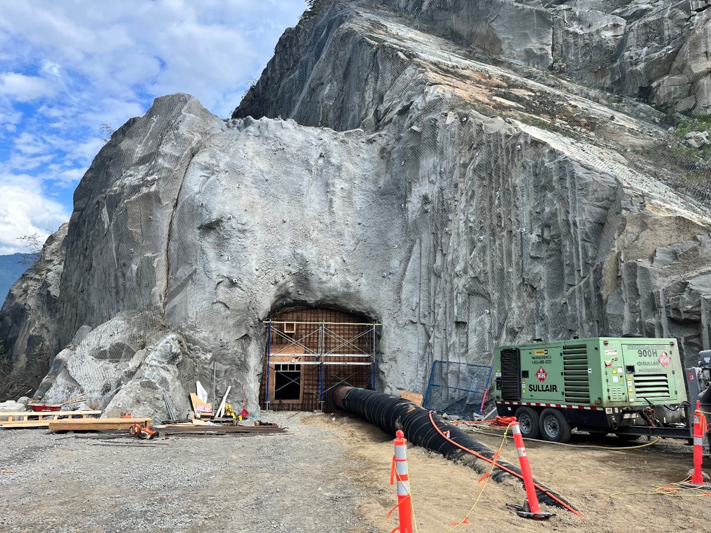
Thurber’s overall scope of work was to provide geotechnical support to the General Construction Contractor (GCC), and provide geotechnical monitoring services during construction, including engineering support, assessment and monitoring services related to metal leaching/acid rock drainage (ML/ARD), geohazards review, vibration monitoring, trenchless tunneling investigation and design input, slope stabilization, retaining wall design, weather monitoring, and erosion control. Our work supported both construction of the pipeline and considered the long-term integrity of the existing and the new pipeline. Thurber worked on Spreads 1, 6 and reactivation of an existing section, but our primary work directives were for Spreads 5A and 5B.
Thurber value-add: weather stations
Construction in BC's Coast Mountain Range is challenging on any given day, but heavy rain, snow, or general freeze/thaw cycles make it dangerous. TMEP passes through such challenging and remote terrain where wet weather conditions can lead to landslides and debris flows big enough to wash out roads and wash away equipment. Because safety is paramount on the project, in 2020 TransMountain hired Thurber to develop a Hazardous Wet Weather Guideline to be used during construction of the Spread 5B portion of the pipeline. The guidelines establish criteria to identify when wet weather conditions are hazardous to workers, outline procedures for initiating temporary shutdown of operations if needed, and provide recommended actions for resuming work.
The rainfall guidelines characterized the alignment into six different zones based on how likely wet weather is to trigger a hazardous event with hazard rating from 1 (no direct geohazard threats) to 6 (high priority geohazard threats). We assigned a baseline rainfall category that would pose a threat in each zone. The guidelines considered pre-construction geohazard classifications, surficial geology, slope steepness, flood-triggering mechanisms, and historical disturbances.
At the onset of this task, TMEP’s environmental group was tasked with collecting and reporting weather data along the spread, but regular collection proved challenging. For this reason, Thurber proposed procuring and installing dedicated weather stations that would allow for immediate and remote data collection that didn’t rely on field staff. Thurber built five portable weather stations that were installed on remote parts at varying locations along the spread. The stations are low maintenance: they run off a car battery charged by solar panels and are easily broken down and transported to site. The weather stations are able to provide weather data including, but not limited to, rainfall, rain, wind speed, and temperature at the site. Thurber receives weather updates every hour.
With work onsite starting early in the morning, our Oakville, ON team (three hours ahead) reviewed the results and send them back to the TMEP crews by 5 am British Columbia time.