Over the past two years, Thurber has been helping the City of Moose Jaw (in Saskatchewan) take a smarter, more efficient approach to managing geohazard risks.
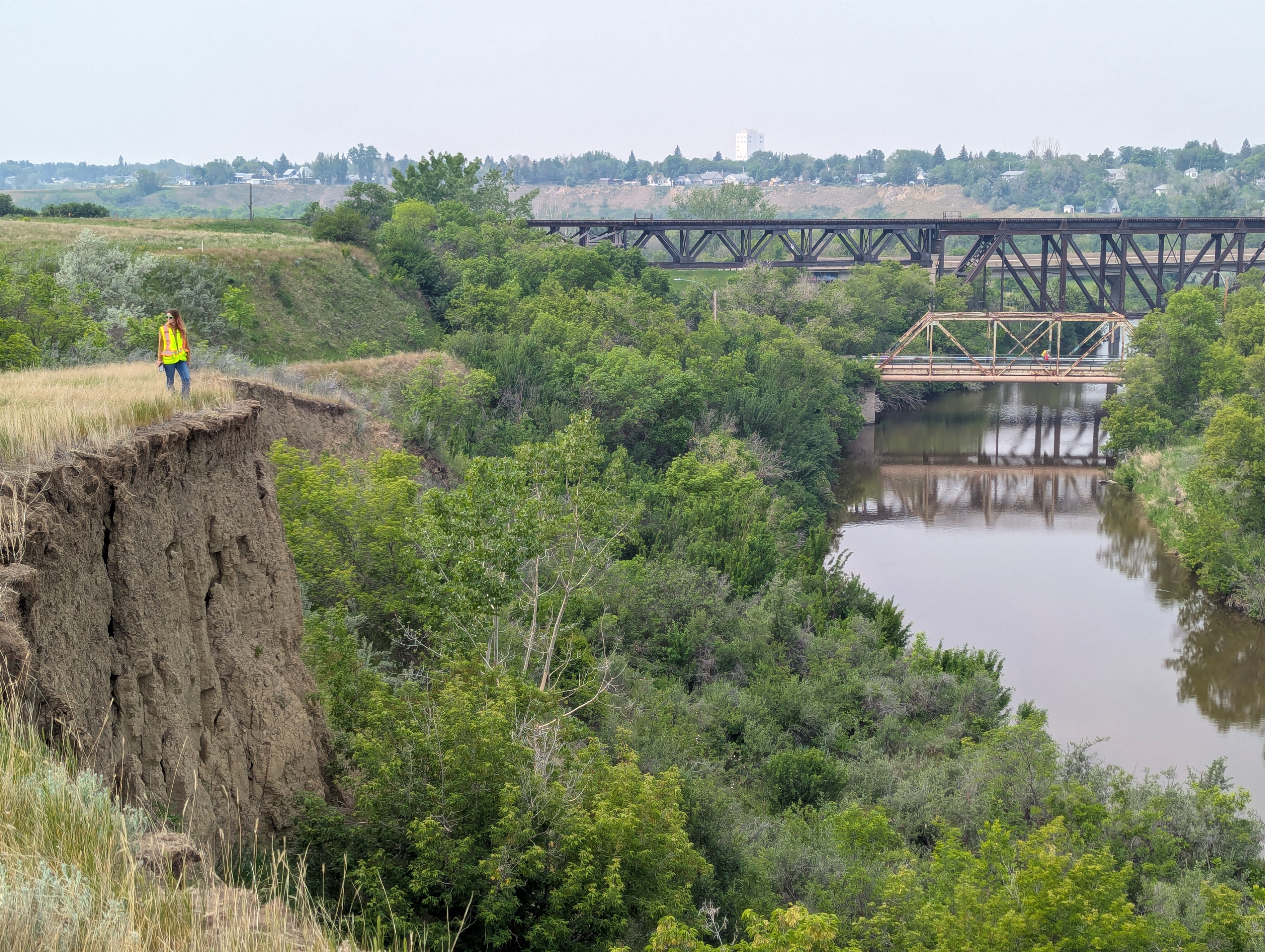
Located at the confluence of the Moose Jaw River, Thunder Creek, and Spring Creek, the City faces ongoing challenges related to erosion and slope instability. These hazards can impact public safety, municipal infrastructure, and future development opportunities, making effective monitoring and risk management essential.
When Thurber assumed responsibility for the City's geohazard monitoring program in 2024, our team quickly identified opportunities to improve how risk was being assessed and managed. The existing system had evolved over many years and, while technically detailed, had become difficult to apply consistently. In many cases, sites were receiving higher risk ratings than conditions warranted, resulting in unnecessary monitoring costs and resources being directed away from locations that required greater attention.
Working closely with City staff, Thurber undertook a comprehensive review of all 47 geohazard sites across Moose Jaw. Drawing on LiDAR data, drone surveys, satellite imagery, historical geotechnical studies, and time-series aerial photography, our team reassessed site conditions, refined risk classifications, and developed a more practical and defensible framework for ongoing monitoring and decision-making.
The results have been significant.
By modernizing the risk assessment approach, Thurber helped reduce the number of sites requiring annual monitoring from 47 to just 10, allowing the City to focus its resources on the locations that present the greatest risk. The updated program has lowered ongoing monitoring costs, improved prioritization of mitigation efforts, and strengthened the City's ability to make informed decisions regarding public safety and infrastructure management.
Beyond monitoring, our team also reviewed Moose Jaw's Official Community Plan and Zoning Bylaw to identify opportunities to improve development controls in slope hazard areas. By aligning planning requirements with current geotechnical data and industry best practices, Thurber provided recommendations that support safer development while reducing unnecessary restrictions on developable land.
This work has delivered benefits across multiple areas:
- Improved public safety through more accurate identification and management of slope hazards
- More efficient use of municipal budgets by focusing monitoring and mitigation efforts where they are needed most
- Stronger, more defensible decision-making frameworks for land-use planning and development approvals
- Enhanced communication with residents and landowners regarding geohazard risks
- Increased long-term resilience through proactive hazard management and updated monitoring practices
Future work will focus on monitoring the highest-priority sites, integrating LiDAR-based hazard tracking into ongoing assessments, refining hazard mapping as new data becomes available, and supporting the City's long-term planning objectives. As Moose Jaw continues to grow, Thurber's work will help ensure development occurs safely and sustainably while protecting critical infrastructure and public spaces.